
A town between two rivers
Orting grew up on a prairie between the Puyallup and Carbon rivers, on ground laid down by ancient mudflows from Mount Rainier. The railroad put it on the map in the 1870s. Hops, dairy farms, daffodil bulbs and Washington's first state veterans home shaped the town that followed. Source
-
c. 1500
The Electron lahar
About 500 years ago, a huge landslide on Mount Rainier's west flank sent a mudflow down the Puyallup River valley. It left deposits up to 20 feet thick and buried an old-growth forest near today's Orting. The flat valley floor the town sits on was formed by that flow. Source
-
Before 1850
Puyallup homeland
The Puyallup Valley is the ancestral home of the Puyallup Tribe. White settlers, drawn by the rich river-bottom soil, began arriving after 1850. Source
-
1854
Treaty and first land claims
On December 26, 1854, Territorial Governor Isaac Stevens pressured local tribal leaders into signing the Medicine Creek Treaty, which pushed the tribes onto small reservations and opened the valley to settlers. Source
-
1865–1891
Hop boom and bust
Ezra Meeker planted the Puyallup Valley's first hops in 1865, and by the early 1880s they were the valley's top crop. From 1870 to 1890 the valley was one of the world's leading hop regions, until hop lice destroyed the crop in 1891. Source
-
c. 1874
Railroad to the coal fields
Around 1874, the Northern Pacific began building a rail line from Tacoma to Wilkeson to reach newly found coal in the Cascade foothills. The line ran through the Orting area. Coal mining in Pierce County went on from the late 1870s into the late 1930s. Source
-
1877–1878
Carbon becomes Orting
The settlement was first known as Gunson's Prairie. A post office opened as 'Carbon' on November 16, 1877, and was renamed Orting on March 13, 1878. Col. S. A. Black, a Northern Pacific superintendent, chose the name, said to be a Native word meaning 'town on the prairie'. Source
-
1889
Incorporation
Orting became an incorporated town shortly after the Northern Pacific laid its tracks. Hop farming and dairying were its main early industries. Source
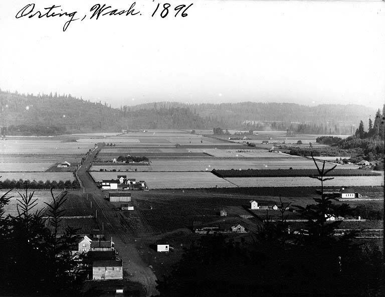
Orting in 1896. Photo: Washington State Library, public domain, via Wikimedia Commons -
1891
Soldiers Home opens
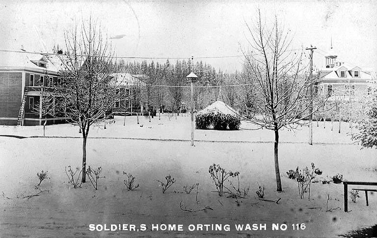
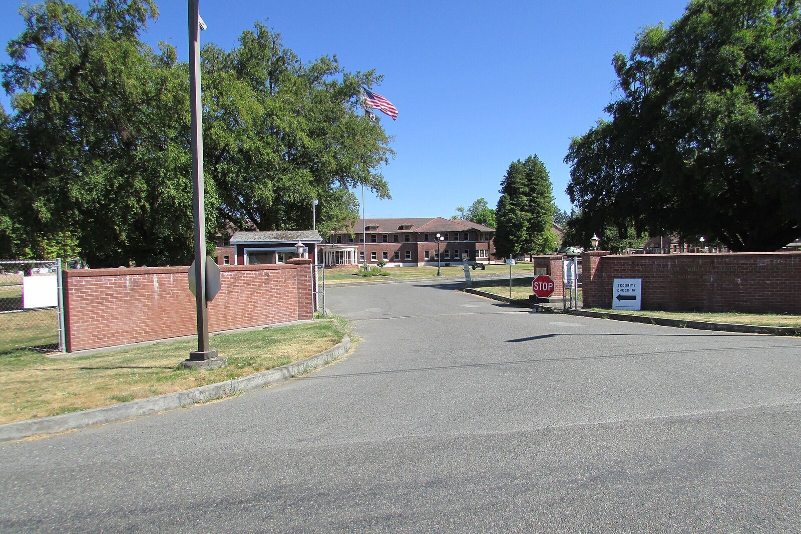
Orting was picked over Puyallup, Vashon and Whidbey for the new state soldiers home, partly because of its excellent water and its rail line. The Grand Army of the Republic dedicated the home on June 25, 1891, and Civil War veteran William Pencil became its first resident on July 4. Source
-
1899
The Soldiers Home Colony
Starting in 1899, the home also worked as a colony. Veterans with families could live in the community and still get a stipend and care. Source
-
1907–1909
Cemetery moved to higher ground
The first Soldiers Home cemetery was on low, flood-prone ground near the Puyallup River. In 1907 the state bought hillside land and moved the burials there, and a memorial monument was dedicated in 1909. Source
-
1920s–1934
Daffodil country
From the 1920s Orting was known for growing bulbs, especially daffodils, on land that had once grown hops. Valley bulb farmers held the first Daffodil Parade on March 17, 1934. The parade now runs through Tacoma, Puyallup, Sumner and Orting in one day. Source
-
1990
Rails become a trail
After the railroad was abandoned and its tracks salvaged in the 1980s, the Pierce County Council made the old line a public linear park in October 1990. Trail building started in 1998, and the stretch through Orting was the original 'Model Mile'. Source
-
1998
Lahar warning system goes live
Several agencies began work in 1995 on an automatic lahar warning system for the Carbon and Puyallup valleys, and it came online in 1998. USGS added 14 new monitoring sites between 2017 and 2021. Source
-
2006–2013
Floods and a new levee
In 2006, Puyallup River flooding caused what was called the largest urban evacuation in state history: 30,000 people from Orting, Fife, Puyallup and Sumner. By 2013 the city was building a $16 million setback levee with about 100 acres of floodwater storage. Source
-
2025
Bridge for Kids under construction
Work started in January 2025 on a roughly $9 million pedestrian bridge over SR 162. It is meant to help residents, schoolchildren among them, reach higher ground quickly if a lahar comes. Check the City of Orting for its current status. Source
The Washington Soldiers Home
Sources
- historylink.org/file/8001
- historylink.org/file/8447
- historylink.org/file/21315
- cdm17061.contentdm.oclc.org/digital/collection/p17061coll4/id/7291/rec/1
- dva.wa.gov/sites/default/files/2020-02/Orting%20History.pdf
- dva.wa.gov/sites/default/files/2020-02/Orting%20Soldiers%20Home%20Cemetery%20Write-up%202018.pdf
- dva.wa.gov/veterans-service-members-and-their-families/veterans-homes/washington-soldiers-home-orting
- pubs.usgs.gov/fs/2008/3062/fs2008-3062.pdf
- wa.water.usgs.gov/pubs/fs/fs_landslide.html
- usgs.gov/volcanoes/mount-rainier/science/monitoring-lahars-mount-rainier
- usgs.gov/news/featured-story/preparing-volcano-hazards-where-worlds-largest-lahar-evacuation-drill-held
- piercecountywa.gov/5888/Outdoor-Warning-System
- piercecountywa.gov/1384/Foothills-Trail
- piercecountywa.gov/4732/Trail-History
- piercecountywa.gov/2340/McMillin-to-Orting
- piercecountywa.gov/2341/Orting-to-South-Prairie
- thedaffodilfestival.org/about/history/
- thedaffodilfestival.org/events/daffodil-parade/
- knkx.org/environment/2013-12-18/with-new-levy-orting-hopes-for-no-more-chronic-flooding-of-puyallup-river
- roadsbridges.com/bridge-construction/news/55271295/washington-moves-forward-with-volcano-evacuation-bridge
- en.wikipedia.org/wiki/Orting,_Washington
- web.archive.org/web/20250531013629/https://localwiki.org/orting/History
Know something we got wrong, or have an old Orting photo to share? Email [email protected].