
Visit Orting.
A small town on the valley floor below Mount Rainier, with a long green park downtown, a paved trail to the rivers, and a parade of daffodils every spring.
At the foot of the mountain
- Orting sits on State Route 162. From SR 167 or SR 512, take the SR 410 exit, then the Orting/Sumner exit onto Route 162 and turn right toward Orting. Source
- The road into town follows the Foothills Trail, much of which runs alongside SR 162 between the McMillin Trailhead (at the meeting of the Puyallup and Carbon rivers) and downtown Orting. Source
- Downtown, the Orting trailhead sits inside Orting City Park, just off the main street. Pierce County notes there is enough parking there, plus restrooms, an information kiosk and a children's play area. Source
- The town lies between the Puyallup and Carbon rivers in central Pierce County. Source
A walk around the park
Scroll the stops, and the map follows. Tap a pin to jump to it.
-
1
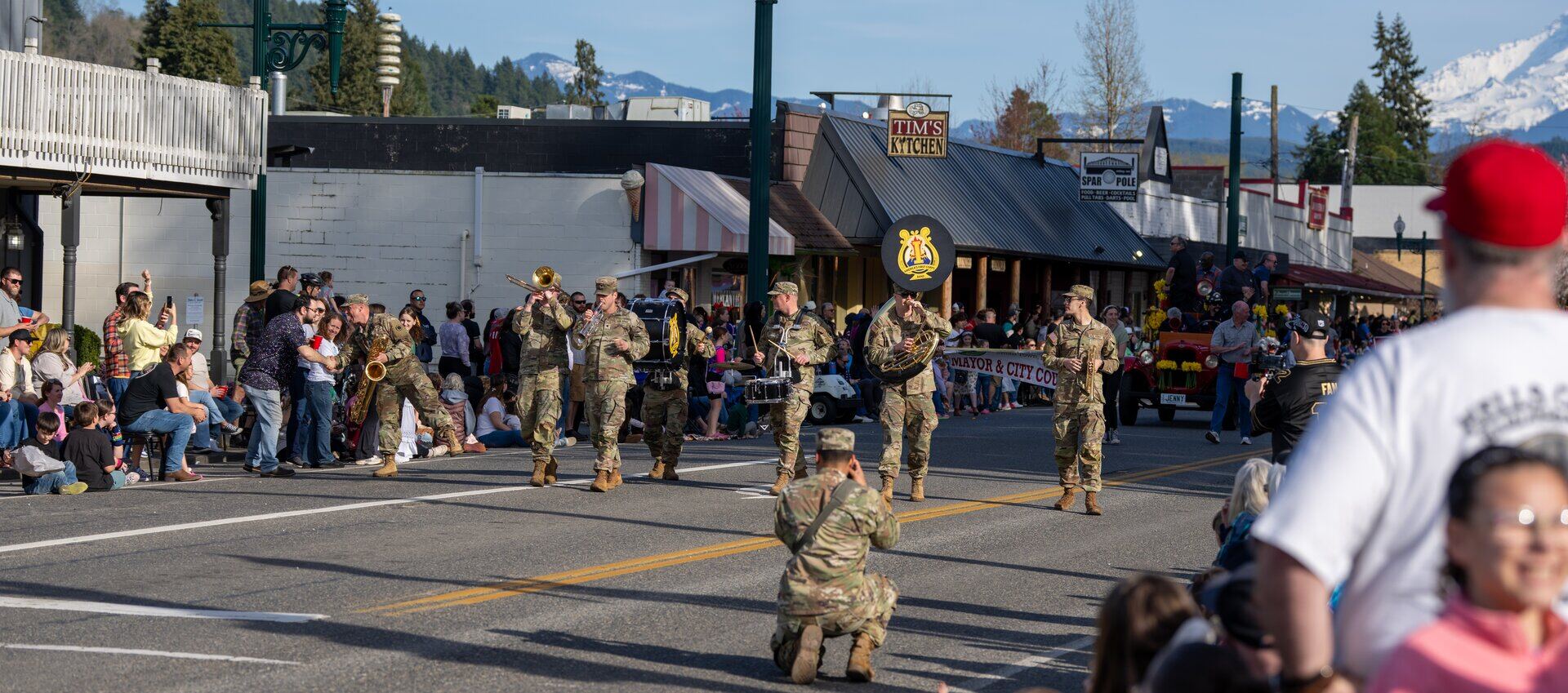
Daffodil Parade day downtown. Photo: Christopher Engelhardt 
The Daffodil Princess float. Photo: Christopher Engelhardt Washington Avenue: the Daffodil Parade route
Orting is the last of the Daffodil Parade's four stops. The parade steps off around 5 p.m. and travels along Washington Avenue, the town's main street. Source
-
2
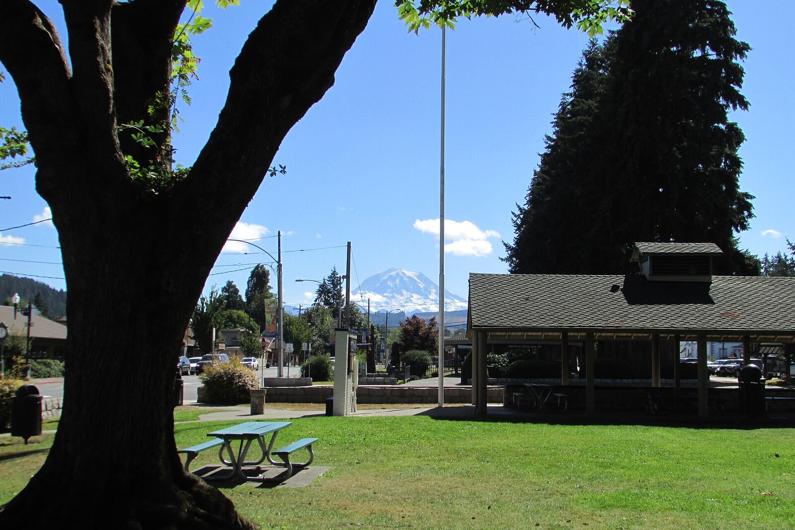
Photo: Chris Light, CC BY-SA 4.0, via Wikimedia Commons 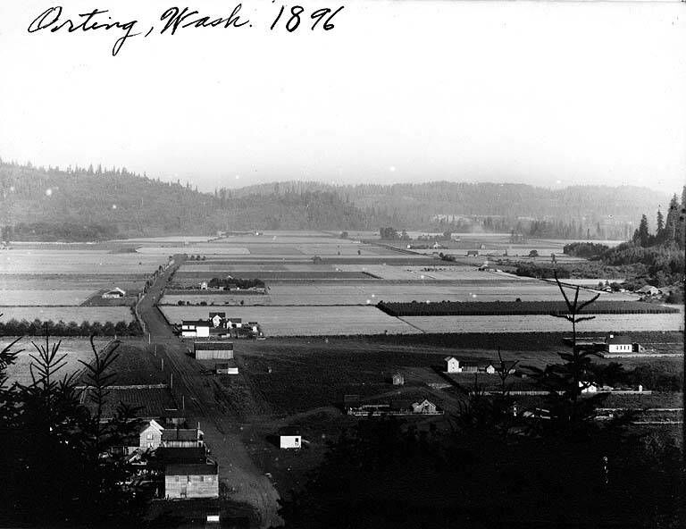
The same valley floor in 1896. Photo: Washington State Library, public domain, via Wikimedia Commons Main City Park
The town's front yard, running beside Washington Avenue. On Daffodil Parade day, food and craft vendors fill it while crowds line the street. Source
-
3
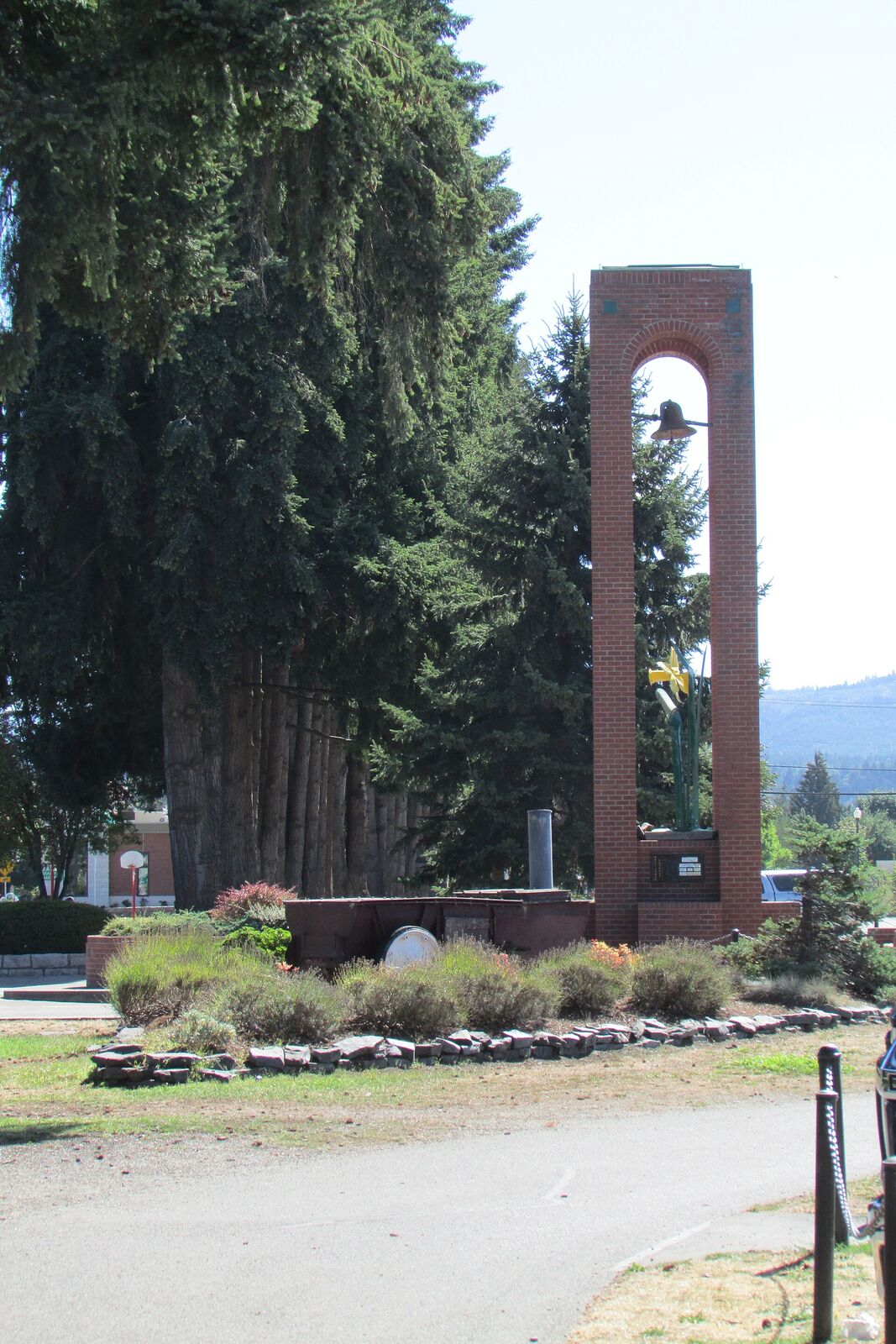
Photo: Chris Light, CC BY-SA 4.0, via Wikimedia Commons 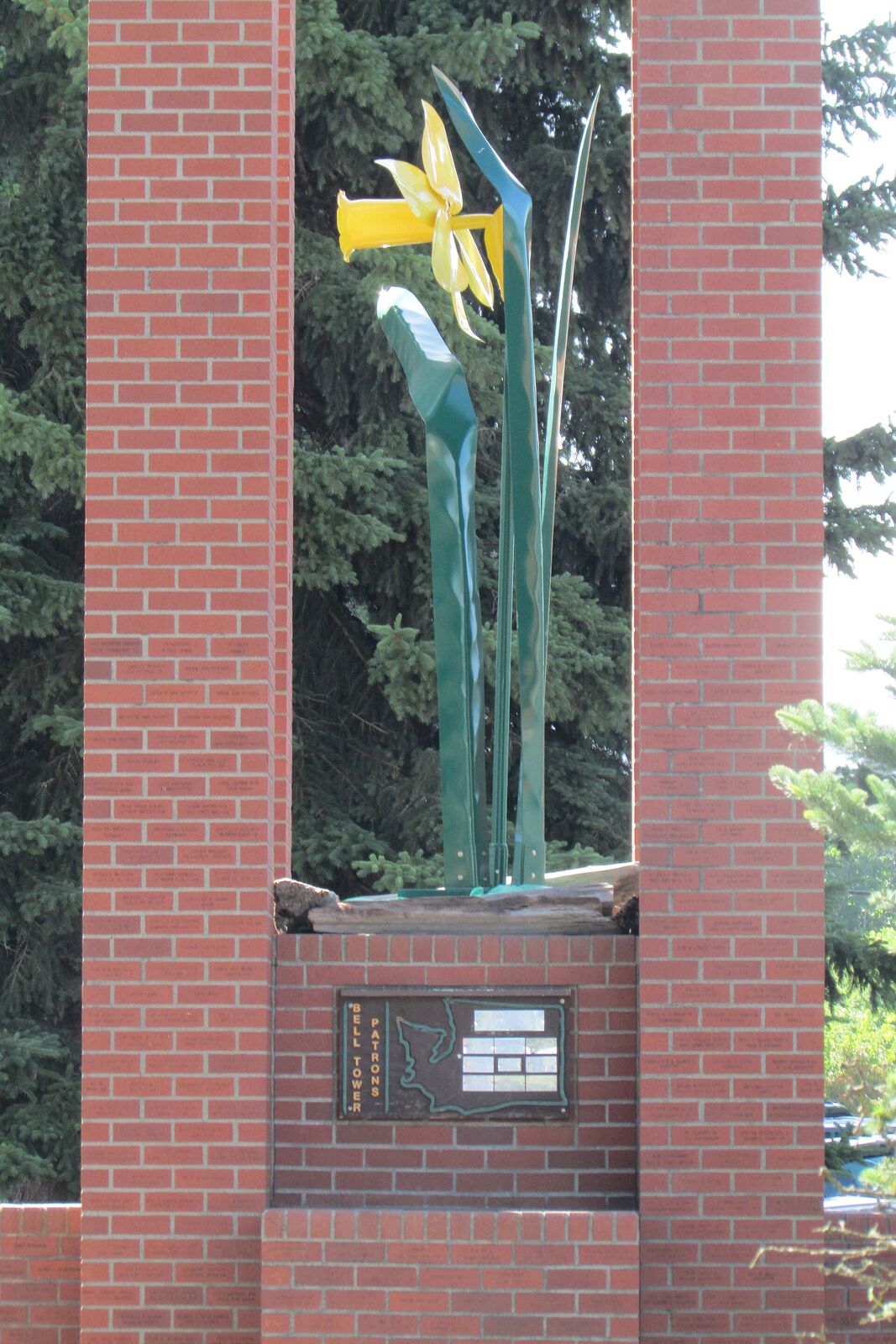
Photo: Chris Light, CC BY-SA 4.0, via Wikimedia Commons Orting Centennial Bell Tower
The tall brick bell tower in Main City Park is one of downtown’s landmarks. Its name marks the town’s centennial, and a daffodil sculpture decorates it. Source
-
4
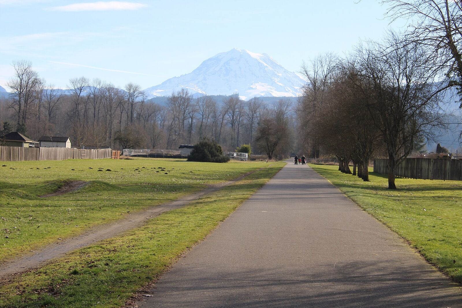
Photo: Chris Light, CC BY-SA 4.0, via Wikimedia Commons 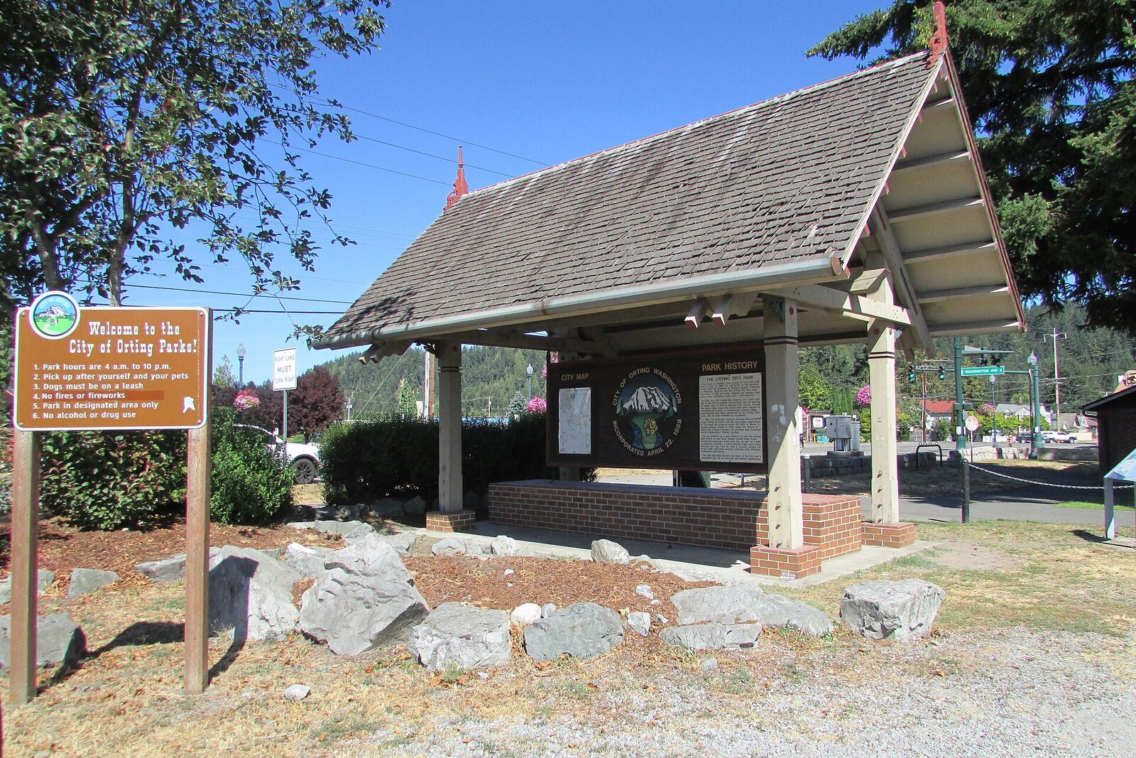
Photo: Chris Light, CC BY-SA 4.0, via Wikimedia Commons Foothills Trail through downtown
The paved trail cuts right through Orting City Park, and the downtown trailhead has parking, restrooms, a kiosk and a play area. Source
-
5
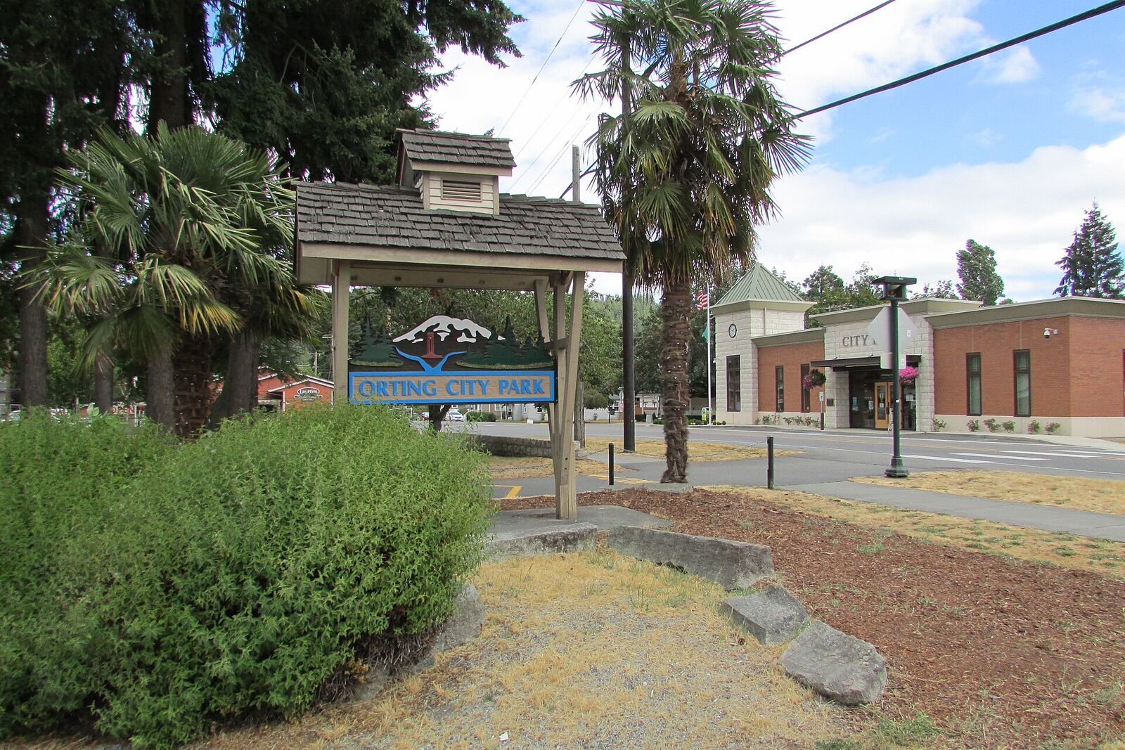
Photo: Chris Light, CC BY-SA 4.0, via Wikimedia Commons Orting City Hall
City Hall stands at 104 Bridge Street South, at the edge of Main City Park. Source
-
6

Orting Valley Farmers Market. Photo: Christopher Engelhardt 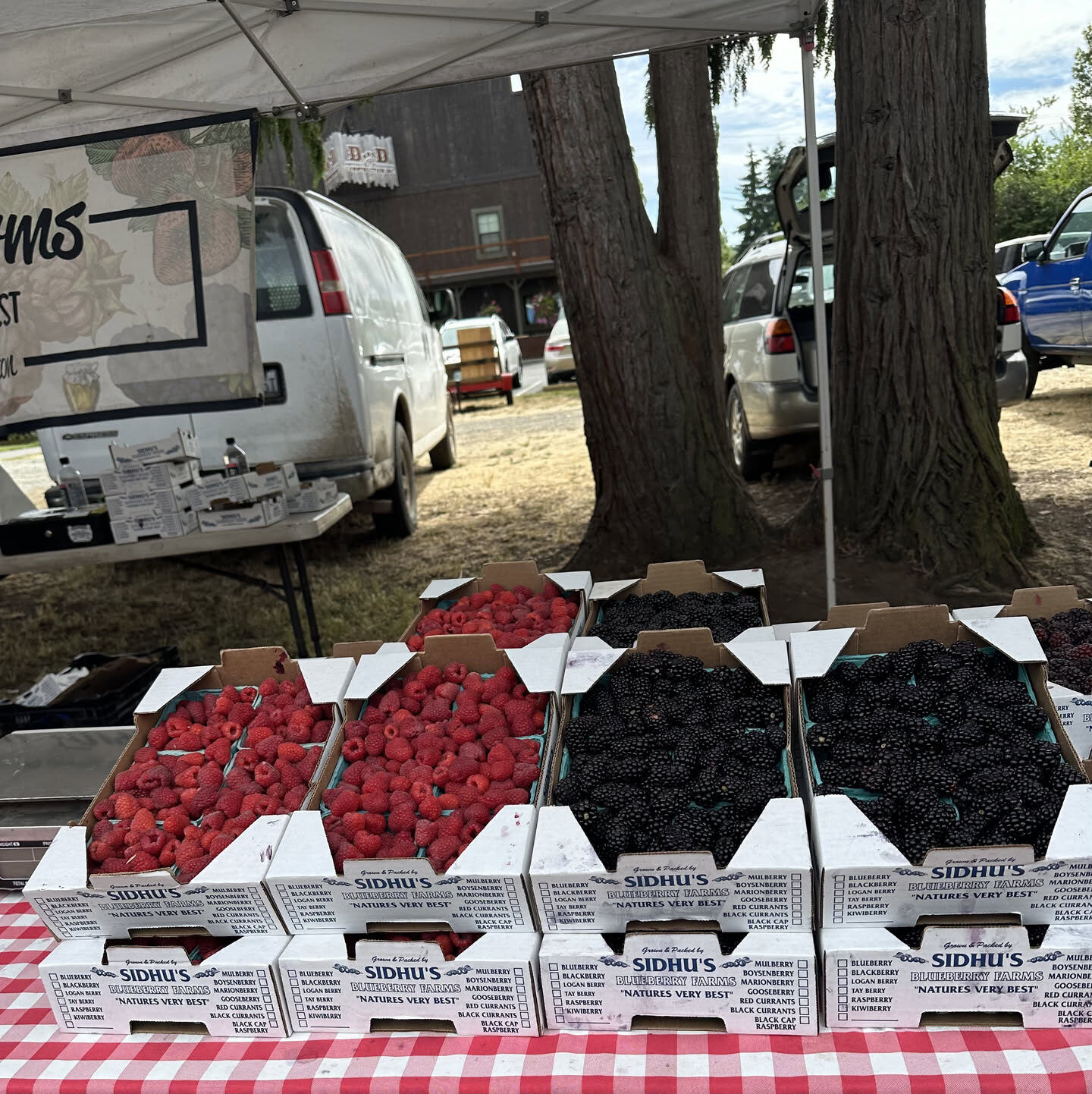
Photo: Christopher Engelhardt North Park: farmers market and the Fourth
The Orting Valley Farmers Market sets up here on Fridays in season. On the Fourth of July, the town's festival fills both North Park and Main City Park. Source
-
7
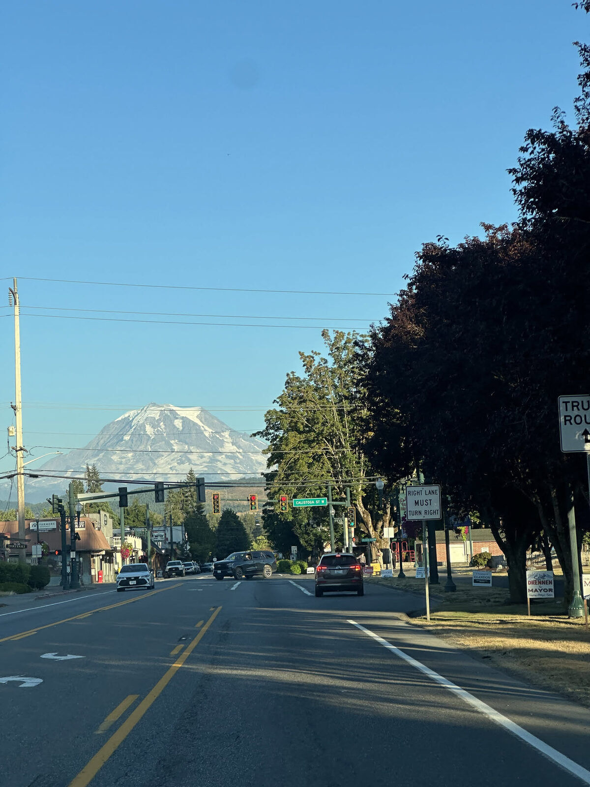
Photo: Christopher Engelhardt Mount Rainier, straight up the street
On a clear day, Mount Rainier fills the end of the street. Pierce County calls the trail out of Orting one of the best places for open views of the mountain. Source
-
8
Bridge for Kids
A pedestrian bridge from the Foothills Trail over SR 162 to Rocky Road Northeast, built so people, schoolchildren especially, can walk to higher ground fast if a lahar comes. Work started in January 2025; check the City of Orting for its current status. Source
Get outside
Foothills Trail
A 22-mile paved trail for walking, biking, skating and wheelchairs, built on an old railroad bed and with a soft shoulder for horses. Pierce County calls the stretch that leaves Orting and follows the Carbon River upstream one of the best spots for open views of Mount Rainier. Source
Orting to South Prairie trail section (Carbon River crossings)
At almost 11 miles, this is the longest section of the Foothills Trail. It passes a cattle farm and a buffalo ranch, crosses the Carbon River, South Prairie Creek and salmon-bearing Voights Creek, and uses four old railroad trestles turned into trail bridges. Source
McMillin Trailhead (Puyallup and Carbon river confluence)
Just past the cement bridge where the Puyallup and Carbon rivers meet, this trailhead starts the 2.3-mile 'Model Mile', the trail's original section, which many people consider its most scenic. It ends 2.2 miles later at Orting City Park. Source
Washington Soldiers Home
Washington's first state veterans home, opened in 1891 and still caring for veterans today on 174 acres in the Puyallup Valley near Orting. The state Department of Veterans Affairs says it serves 128 residents. Source
Washington Soldiers Home Cemetery
This 8-acre hillside cemetery holds 2,265 veterans and spouses, including four Civil War Medal of Honor recipients. A monument put up by the Women's Relief Corps was dedicated here in 1909. Source
Orting Valley Farmers Market
A nonprofit market with local growers, food, crafts, free activities and entertainment. It runs Friday afternoons in season at North Park downtown. Source
Mark the calendar
Daffodil Parade (Orting leg)
The Grand Floral Parade passes through Tacoma, Puyallup, Sumner and Orting in a single day, and Orting comes last. Floats are covered in fresh-cut daffodils. Source
Orting Valley Farmers Market season
Held at North Park, the market has local produce, plants, artisan goods and free family activities. Source
4th of July Festival
The City of Orting and the Orting Valley Farmers Market host a free festival at Main City Park and North Park, with food, local vendors, live entertainment and a kids' zone. Source
Orting Harvest Festival
A free fall festival held at the Orting Valley Farmers Market, with vendors, food, drinks and pumpkin carving. The 2025 event was the second one. Source
If you hear a siren
- Orting is in a lahar zone. A lahar is a fast-moving flow of volcanic mud and debris from Mount Rainier. The town is built on deposits left by the Electron lahar about 500 years ago, and that lahar was probably not caused by an eruption. Source
- Pierce County runs 42 outdoor warning sirens in the Puyallup and Nisqually river valleys. They give voice warnings in English and Spanish and flash strobe lights. Source
- The sirens are tested at noon on the first Monday of each month. The test is a chime like a Westminster clock, followed by a voice announcement. If you hear the chime on a first Monday, it is only a test. Source
- In a real emergency the sirens give a continuous 'wail', strobe lights flash and a spoken warning follows. If you hear it, leave the valley floor and get to higher ground. Source
- Sensors buried along the rivers listen for lahars and trigger the warning. USGS estimates that a large lahar could reach Orting as little as 40 minutes after the first warning, so move promptly. Source
- Residents can also get emergency warnings through Pierce County's PCALERT system. Source
- Orting schools have practiced lahar evacuations since the early 1990s. In the March 21, 2024 regional drill, around 13,000 students walked up to 2 miles to spots outside the mapped lahar zone. Source
Curious how Orting got here? Orting history & timeline →